Historical Maps of Bulgaria
MAP COLLECTIONS & atlases
- Blank and Outline Maps of Bulgaria (d-maps.com)
- Atlas po Bolgarska istorija
- Bulgaria: Historical Maps Collection (Library of Congress)
- Historical Maps of Bulgaria (American Geographical Society Library Digital Map Collection)
- Historical Maps of Bulgaria (David Rumsey Map Collection)
- Historical Maps of Bulgaria (bulstack.com)
- Old Maps of Bulgaria (oldmapsonline.org)
- The Bulgarians in their historical, ethnographical and political frontiers - Atlas with 40 maps (1917)
MAPS
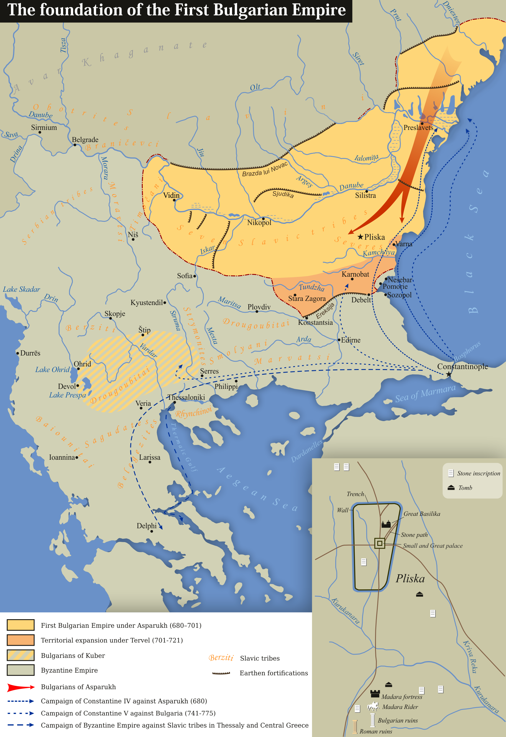
- The Foundation of the First Bulgarian Empire
- Bulgarian Second Empire Lands and the Turkish Conquest 1345-1351
- Carte de la Bulgarie, c. 1850
- Turkey in Europe, 1858 (J. Arrowsmith)
- Balkan States & Ottoman Empire, 1877-1878 (Stanford’s Popular Map of the Seat of War)
- Sketch Map of Western Turkey in Europe, 1909 (U .S. War Office)
- Physical Map of the Balkan Peninsula, 1912 (in Bulgarian)
- Map of the Kingdom of Bulgaria, 1912 (in Bulgarian)
- The Balkan states showing boundaries finally adopted, 1913 (W. Sloane)
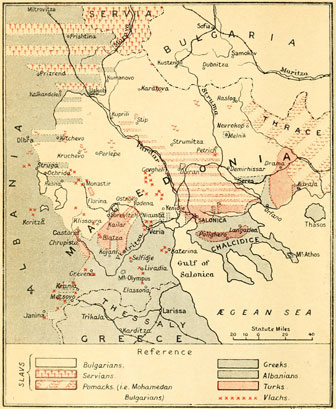
- Ethnic Map of the Balkan Peninsula, 1914 (in German, J. J. Kettler)
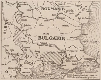
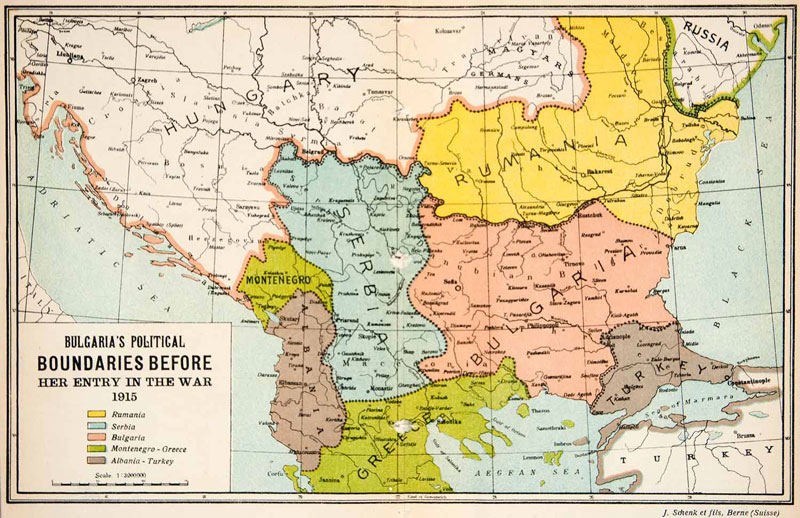
- Bulgaria’s political boundaries before her entry in the war, 1915
- Ethnographic Map of the Balkan Peninsula, 1918 (Jovan Cvijić)
- Zones of Civilization of the Balkan Peninsula (Jovan Cvijić)
- Ethnic Map of Bulgaria, 1918 (in German, A. Ischirkoff)
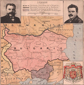
- Bulgaria and its Boundaries from the Treaty of Constantinople to the Treaty of Neuilly (in German)
- Bulgaria, 1920-1940