REGIONAL MAPS: CENTRAL & eastern EUROPE
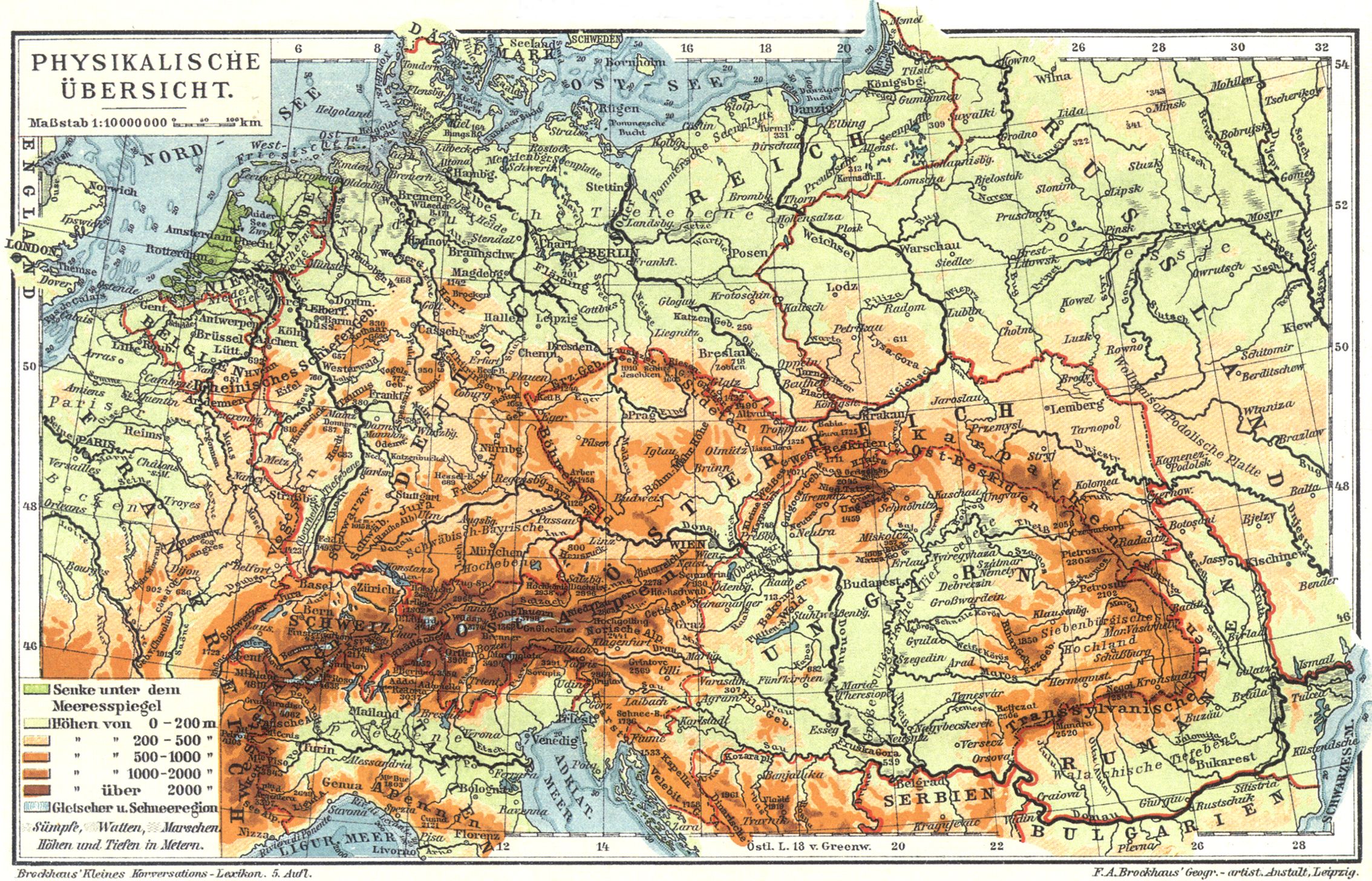
- Mitteleuropa: Physikalische Übersicht
- Central Europe in Carolingian Times (Droysens Allgemeiner Historischer Handatlas, 1886)
- Population of Central Europe around 900 (Putzgers Historischer Weltatlas, 1905)
- Central Europe in the 15th Century (1477) (Putzgers Historischer Weltatlas, 1923)
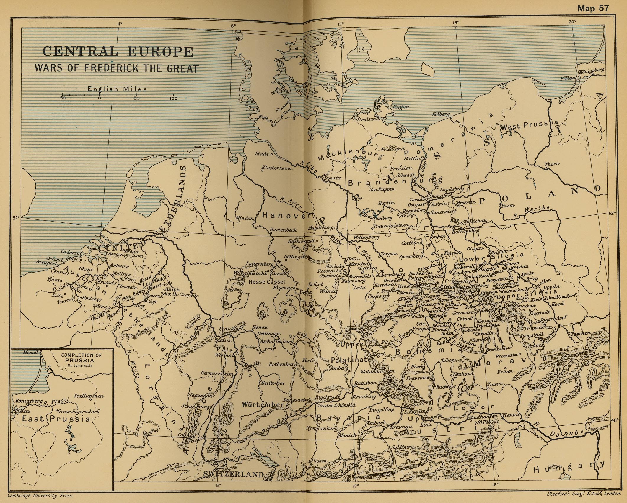
- Central Europe: Wars of Frederick the Great (Cambridge Modern History Atlas, 1912)
- Central Europe on the Eve of the French Revolution (1786)
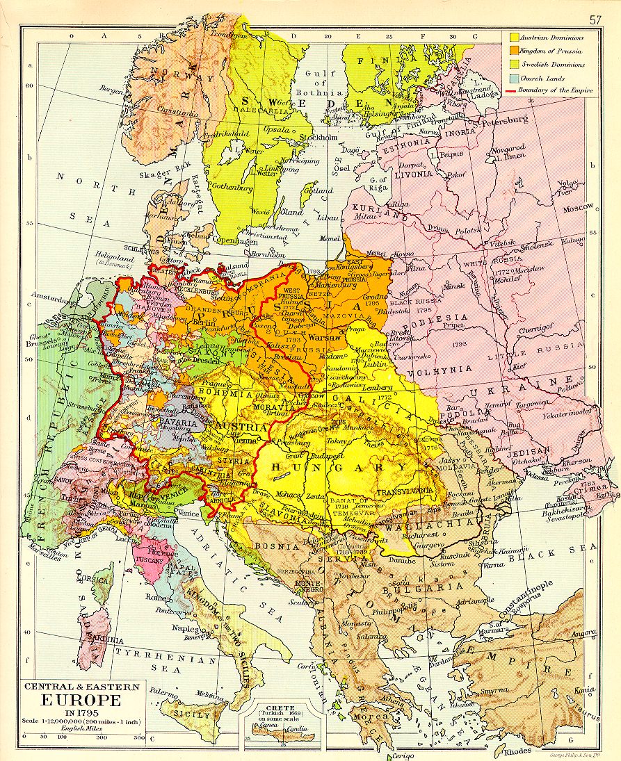
- Central and Eastern Europe in 1795
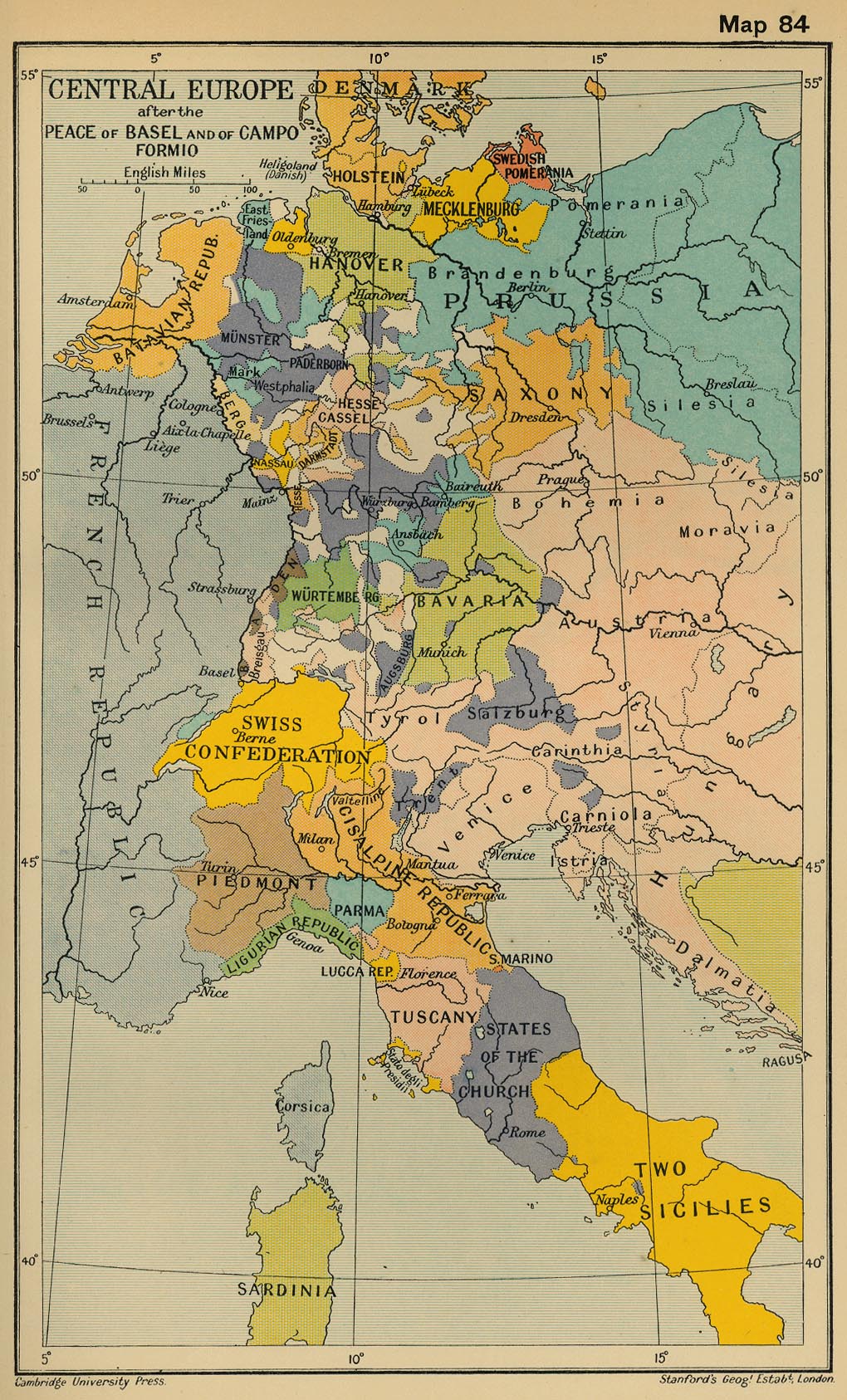
- Central Europe after the Peace of Basel and of Campo Formio (Cambridge Modern History Atlas, 1912)
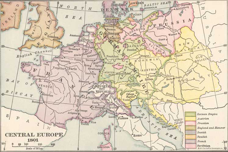
- Central Europe, 1801
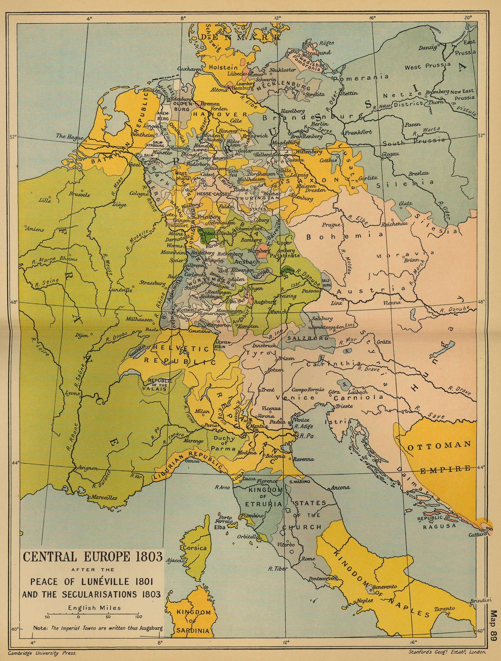
- Central Europe, 1803 (Cambridge Modern History Atlas, 1912)
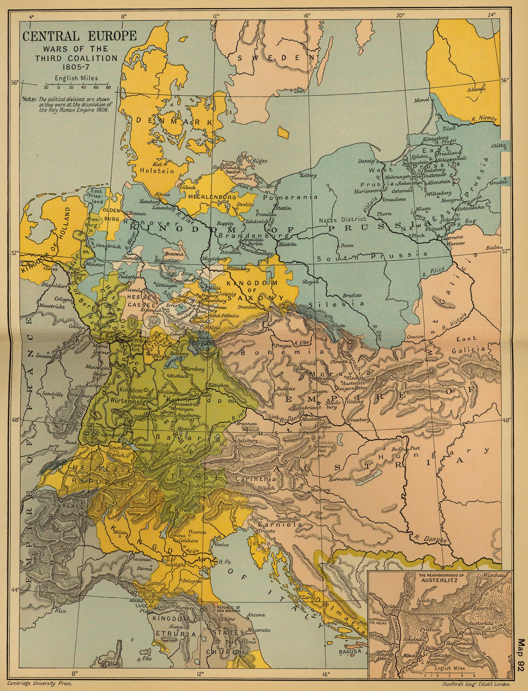
- Central Europe: Wars of the Third Coalition 1805-1807 (Cambridge Modern History Atlas, 1912)
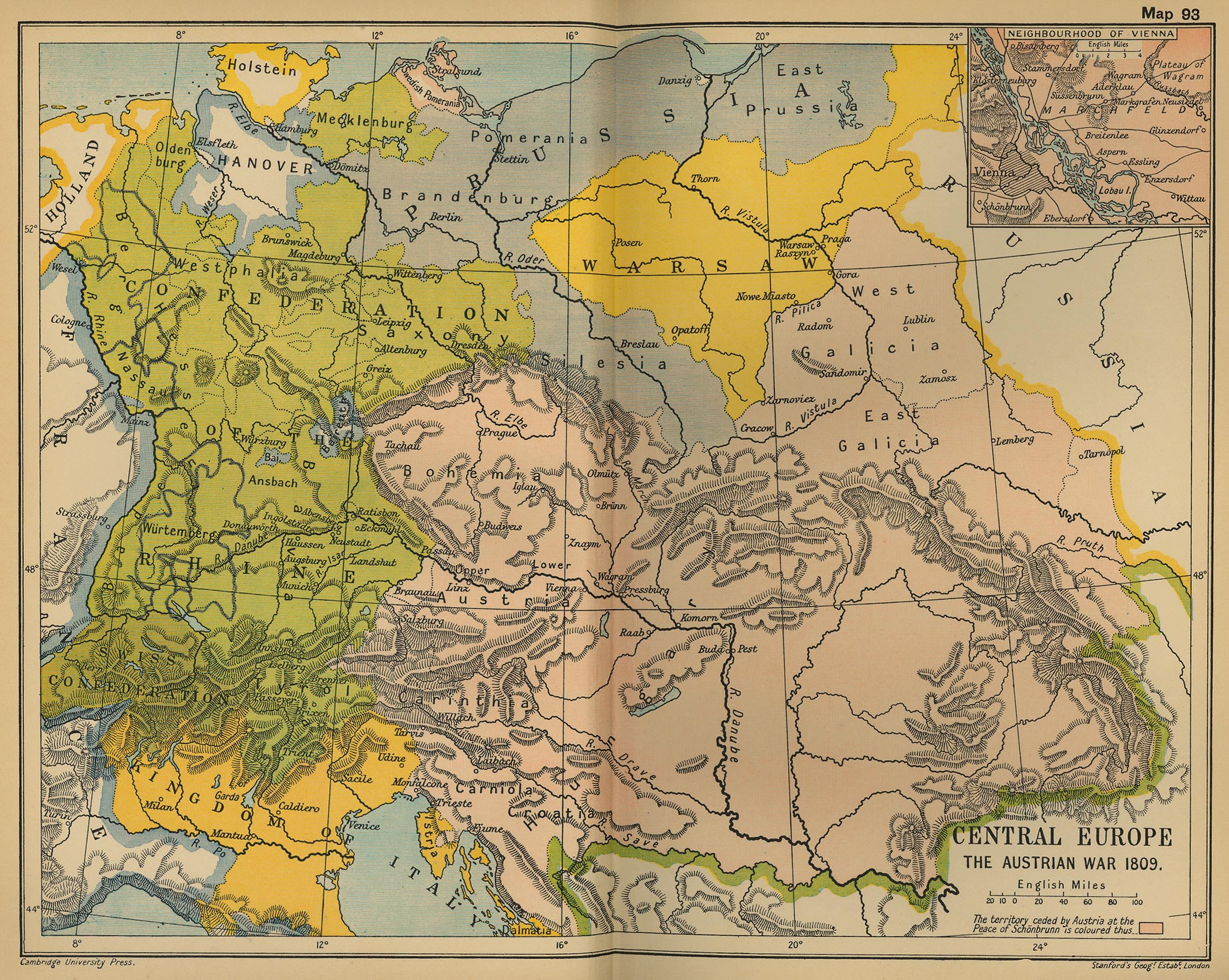
- Central Europe, 1809: The Austrian War (Cambridge Modern History Atlas, 1912)
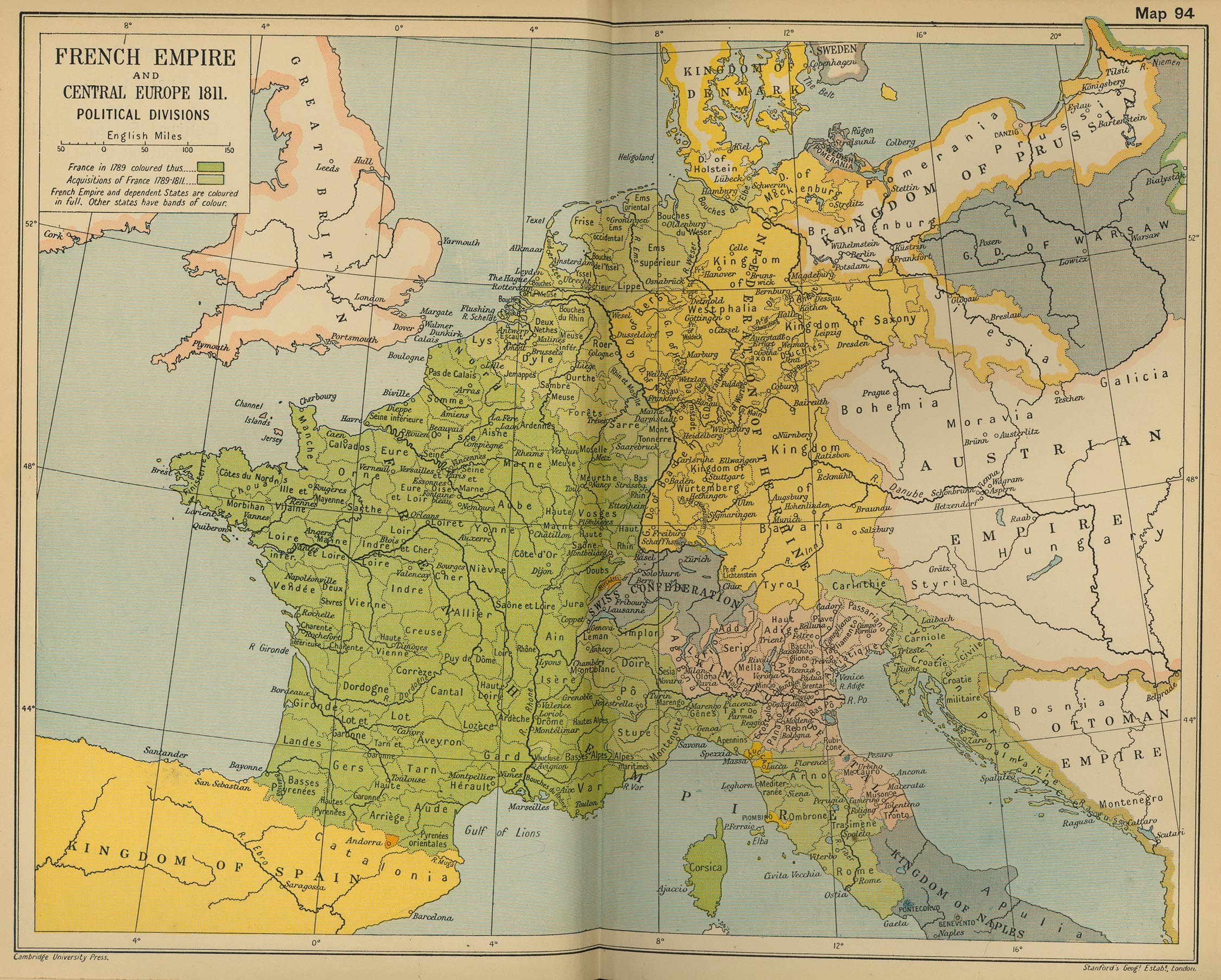
- French Empire and Central Europe, 1811 - Political Divisions (Cambridge Modern History Atlas, 1912)
- Central Europe, 1812 (IEG-Maps)
- Central Europe at the Height of Napoleonic Power (1812)
- Central Europe, 1815-1866
- Central Europe, 1848 (IEG-Maps)
- Central Europe, 1867 (IEG-Maps)
- Central Europe, 1871 (IEG-Maps)
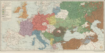
- Ethnographical Map of Central and South Eastern Europe, 1916 (British War Office)
- Eastern Europe: Ethnic Map, 1920 (American Geographical Society Library)
- Central Europe, 1944 - Allied Occupation Zones
- Central Europe, 2000
Historical Maps of Europe (3)