Historical Maps of Germany (1)
MAP COLLECTIONS & atlases
- Blank and Outline Maps of Germany (d-maps.com)
- German History Maps I - The Essential List, 1500-1870 (Helmut Walser Smith)
- German History Maps II - The Essential List, 1870-1945 (Helmut Walser Smith)
- Germany: Historical Maps Collection (Library of Congress)
- Historical Maps of Germany (American Geographical Society Library Digital Map Collection)
- Historical Maps of Germany (David Rumsey Map Collection)
- Historical Maps of Germany
- Historical Maps of Germany, 1378-2003 (Institut of European History - Mainz)
- Historical Maps of Germany before 1825 (University of Alabama)
- Historische Karten - Deutsches Reich 1789 (Thomas Hoeckmann)
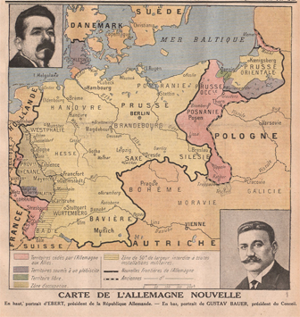
- L’Allemagne en cartes (Gallica - Bibliothèque nationale de France)
- Old Maps of Germany (oldmapsonline.org)
MAPS
- Central Europe in Carolingian Times (Droysens Allgemeiner Historischer Handatlas, 1886)
- Carolingian and Eastern Roman Empire (Putzgers Historischer Weltatlas, 1905)
- Germany around the Year 1000 (Droysens Allgemeiner Historischer Handatlas, 1886)
- Holy Roman Empire. circa 1000 (worldhistory.org)
- Holy Roman Empire in 1356
- Germany in the 14th Century (Droysens Allgemeiner Historischer Handatlas, 1886)
- The Growth of Prussia (Muir’s Historical Atlas, 1911)
- Germany in the 15th Century (Droysens Allgemeiner Historischer Handatlas, 1886)
- Germany at the Accession of Charles V (Cambridge Modern History Atlas, 1912)
- Holy Roman Empire, c. 1500
- Brandenburg-Prussia Expansion 1525-1648 (Cambridge Modern History Atlas, 1912)
- Germany. The Schmalkaldic War (Cambridge Modern History Atlas, 1912)
- Germany at the Time of the Reformation (1547) (Putzgers Historischer Weltatlas, 1905)
- Germany at the Time of the Reformation (Droysens Allgemeiner Historischer Handatlas, 1886)
- Allemagne après la paix d’Augsbourg (1555) (Vidal-Lablache, Atlas général d'histoire et de géographie, 1912)
- Dominions of the House of Habsburg in Europe at the Abdication of Charles V (Cambridge Modern Hist. Atlas, 1912)
- Growth of Brandenburg-Prussia, 1600-1795 (Mapping Solutions)
- Growth of the Habsburg Dominions (Muir’s Historical Atlas, 1911)
- Germany: The Peace of Westphalia (Cambridge Modern History Atlas, 1912)
- Germany after the Peace of Westphalia (Charles Colbeck, The Public Schools Historical Atlas, 1905)
- Germany at the Time of the 30 Years War (Droysens Allgemeiner Historischer Handatlas, 1886)
- The Netherlands and Western Germany: The Wars of 1648-1715 (Cambridge Modern History Atlas, 1912)
- Prussia: Territorial Expansion 1648-1795 (Cambridge Modern History Atlas, 1912)
- Alsace-Lorraine from 1648 to 1789
- Central Europe: Wars of Frederick the Great (Cambridge Modern History Atlas, 1912)
- Poland: The Partitions (Cambridge Modern History Atlas, 1912)
- The Empire and the Netherlands, c. 1792 (Cambridge Modern History Atlas, 1912)
- South West Germany and North Italy: The War of the Second Coalition 1798-1801 (CMHA, 1912)
- Central Europe 1803 after the Peace of Luneville 1801 and the Secularisations 1803 (CMHA, 1912)
- Germany and Italy, 1803 (Mapping Solutions)
- Central Europe: Wars of the Third Coalition 1805-1807 (Cambridge Modern History Atlas, 1912)
- Central Europe: The Austrian War 1809 (Cambridge Modern History Atlas, 1912)
- French Empire and Central Europe 1811 Political Divisions (Cambridge Modern History Atlas, 1912)
- Germany in 1812 (Droysens Allgemeiner Historischer Handatlas, 1886)
- Germany and Eastern France: The War of Liberation 1813-1814 (Cambridge Modern History Atlas, 1912)
- The Confederation of the Rhine, 1812 (IEG-Maps)
- The Germanic Confederation 1815 (Cambridge Modern History Atlas, 1912)
- German Confederation, 1820 (IEG-Maps)
- Kingdom of Bohemia, 1847
- German Confederation, 1848 (IEG-Maps)
- Kingdom of Bohemia, 1850 (Justus Perthes)
- Eastern France: The Franco-Prussian War 1870-1871 (Cambridge Modern History Atlas, 1912)
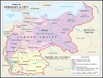
- Germany, 1871 (IEG-Maps)
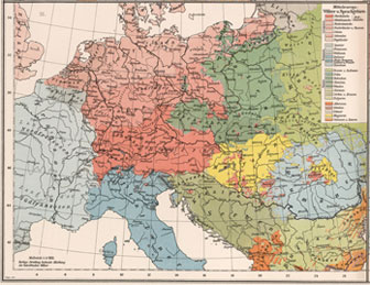
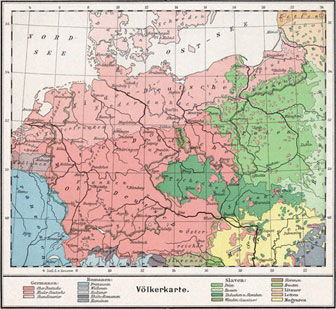
- Ethnic and Linguistic Map of Germany, 1872 (Völker- und Sprachen-Karte von Deutschland) (Heinrich Kiepert)
- Germany, 1890: Population Density
- Linguistic (Dialect) Map of Germany, 1905: Karte der Deutschen Mundarten (Emil Maurmann)
- Alsace-Lorraine, 1910


