Historical Maps of Italy (1)
MAP COLLECTIONS & atlases
- Blank and Outline Maps of Italy (d-maps.com)
- Italy: Historical Maps Collection (Library of Congress)
- Italy: Mappe e carte geografiche della grande guerra (Ministero della Cultura - Italia)
- Historical Maps of Italy (American Geographical Society Library Digital Map Collection)
- Historical Maps of Italy (David Rumsey Map Collection)
- Mappe storiche d’Italia (stagniweb.it)
- Old Maps of Italy (oldmapsonline.org)
- Lazio: Rappresentazioni Cartografiche Storiche del Lazio (Geoportale cartografico - Roma Capitale)
- Lombardy: Atlante dei catasti storici e delle carte topografiche della Lombardia (Archivio di Stato di Milano)
- Milan: Cartografie storiche di Milano (Comune di Milano)
- Milan: Mappe storiche di Milano (Repertorio di Milano)
- Piedmont: Cartografia storica (Archivio di Stato di Torino)
- Reggio Emilia: Cartografia storica (Provincia di Reggio Emilia)
- Rome: Rappresentazioni Cartografiche Storiche della Città di Roma (Geoportale cartografico - Roma Capitale)
- Rome: Cartografia storica di Roma e provincia (Isidoro Bonfà)
- Rome: Mappe storiche di Roma e del Lazio (Archivio Storico Capitolino)
- Tuscany: Cartografia storiche regionale (CASTORE - Regione Toscana)
- Venice: Atlante della laguna - Cartoteca storica (ISMAR-Venezia)
MAPS
- Italy in the Time of the Lombards (Droysens Allgemeiner Historischer Handatlas, 1886)
- Italy in the 10th-11th Centuries (Droysens Allgemeiner Historischer Handatlas, 1886)
- Italy in the 10th and 11th Centuries (Putzgers Historischer Weltatlas, 1905)
- Italy about 1050
- L’Italia al tempo dei comuni (sec. XII e XIII)
- Italy, c. 1300 (Droysens Allgemeiner Historischer Handatlas, 1886)
- L’Italia sotto le signorie (sec. XIV)
- Northern Italy in the XIVth and the XVth Centuries (R. Lane Poole, Hist. Atlas of Modern Europe, c.1900)
- The House of Savoy in Italy, 1418 (R. Lane Poole, Historical Atlas of Modern Europe, c.1900)
- The Growth of the House of Savoy in Italy (1418 & 1748) (R. Lane Poole, Historical Atlas of Modern Europe, c.1900)
- Italy after the Peace of Lodi (1454) (R. Lane Poole, Historical Atlas of Modern Europe, c.1900)
- L’Italia dopo la Pace di Lodi (1454)
- Italy in its Ecclesiastical Div. 12th-15th Centuries (R. Lane Poole, Hist. Atlas of Modern Europe, c.1900)
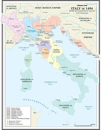
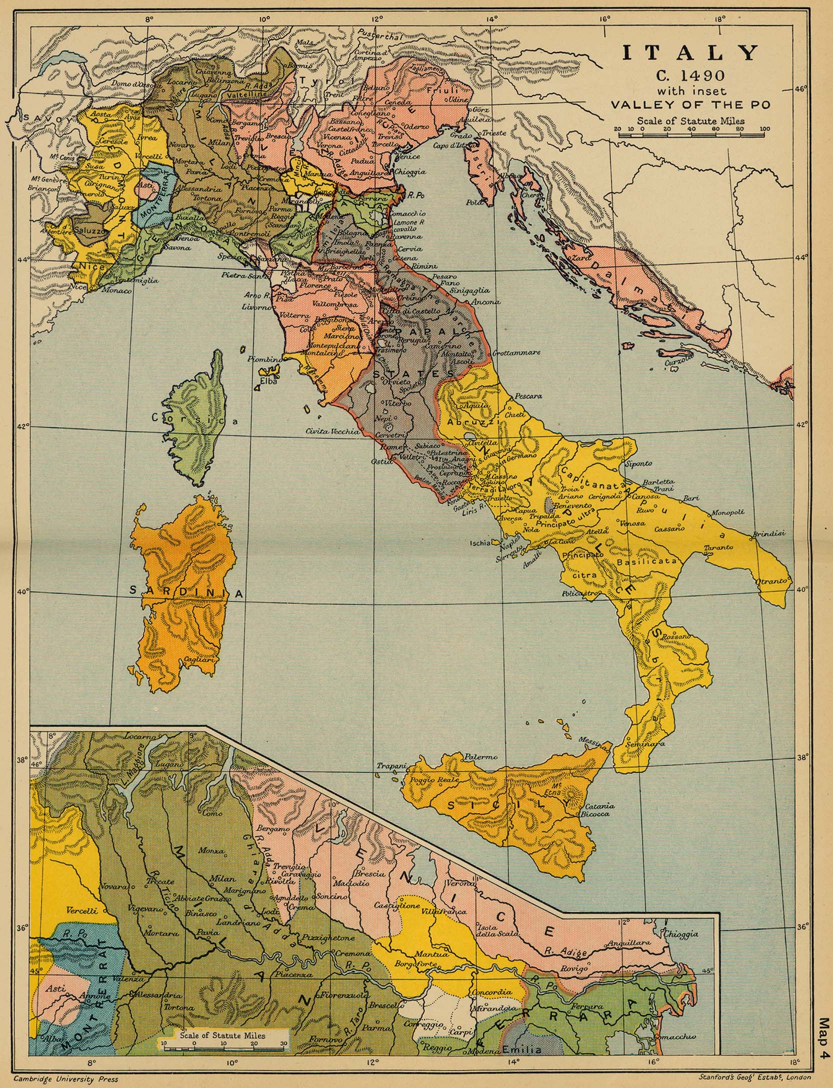
- Italy, c. 1490 (Cambridge Modern History Atlas, 1912)
- L’Italia verso il 1492
- Italy in the 15th-18th Centuries (Droysens Allgemeiner Historischer Handatlas, 1886)
- Italy at the Close of the 15th Century
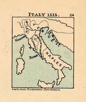
- Italy in 1515 (Charles Colbeck, The Public Schools Historical Atlas, 1905)
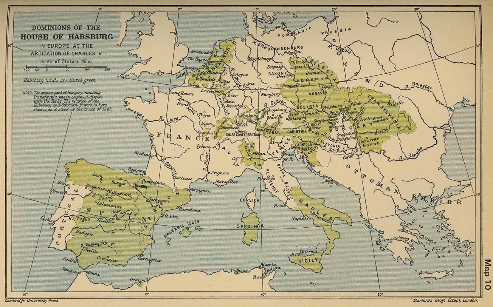
- House of Habsburg in Europe at the Abdication of Charles V (Cambridge Modern History Atlas, 1912)
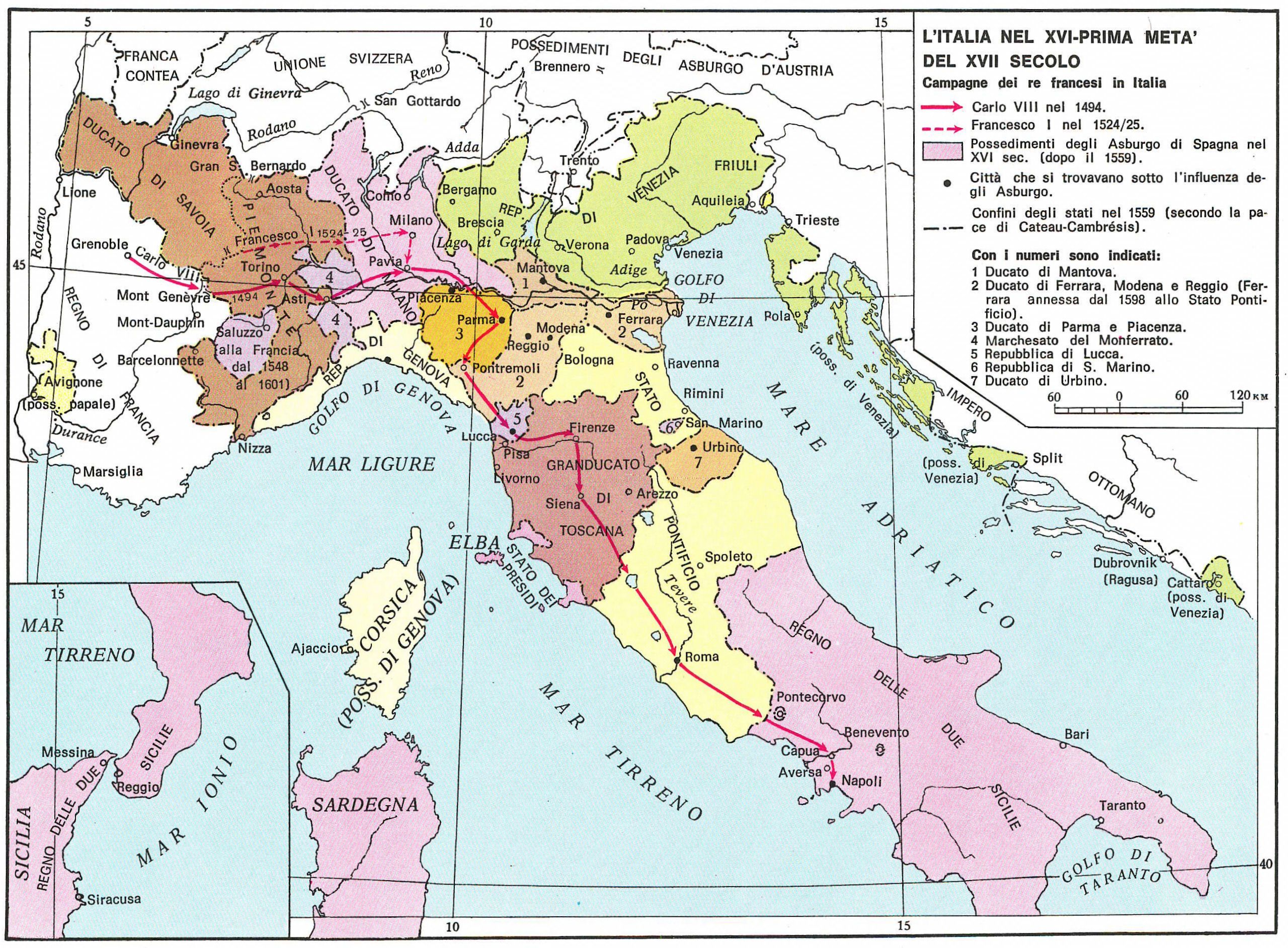
- Italy After the Peace of Cateau-Cambrésis, 1559 (L’Italia nel XVI-prima meta’ del XVII Secolo)
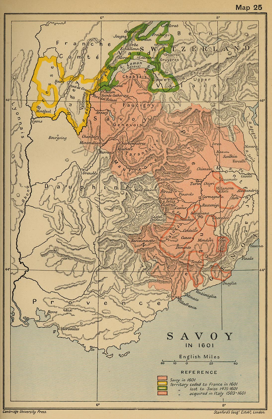
- Savoy in 1601 (Cambridge Modern History Atlas, 1912)
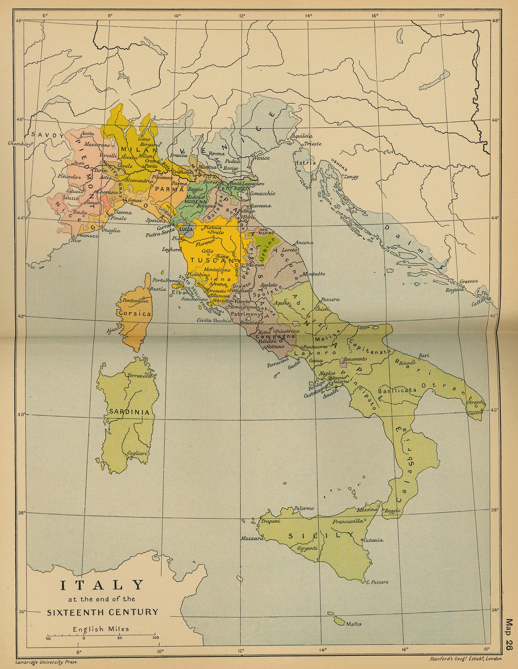
- Italy at the end of the Sixteenth Century (Cambridge Modern History Atlas, 1912)
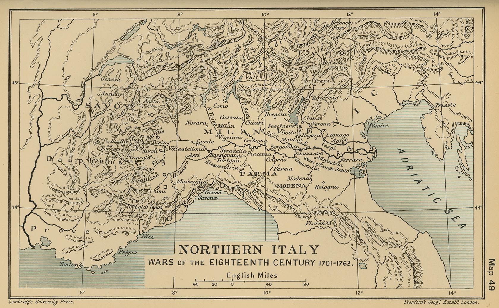
- Northern Italy: Wars of the Eighteenth Century 1701-1763 (Cambridge Modern History Atlas, 1912)
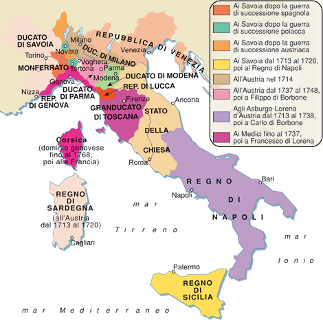
- L’Italia nel 1748
- Granducato di Toscana nell’ultimo quarto del XVIII secolo
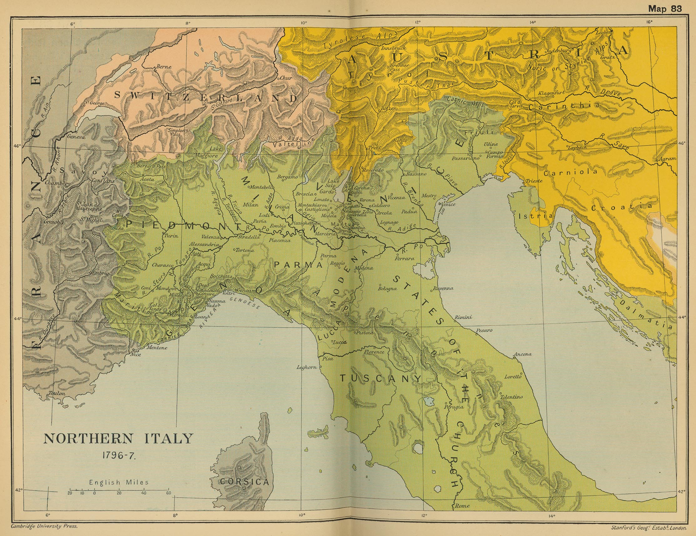
- Northern Italy: Bonaparte's Campaign 1796-1797 (Cambridge Modern History Atlas, 1912)
- Carte des États de la République de Venise (ante 1797) (P. Daru, 1819)
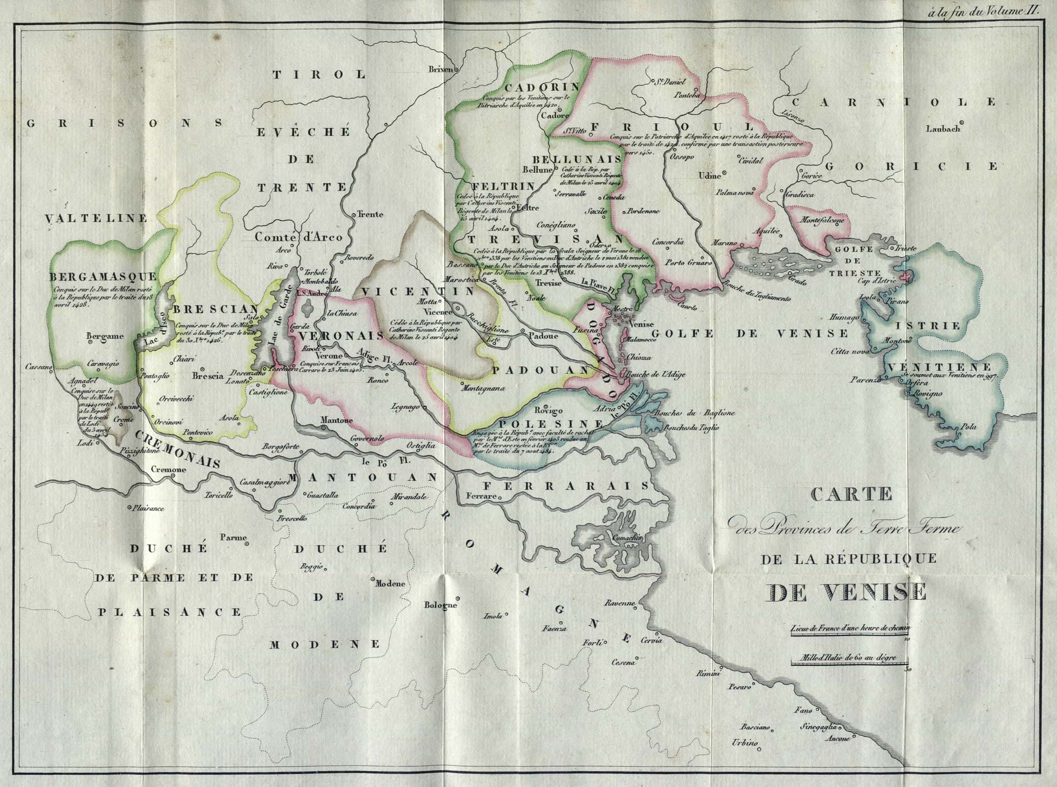
- Carte des provinces de Terre Ferme de la République de Venise (ante 1797) (P. Daru, 1819)
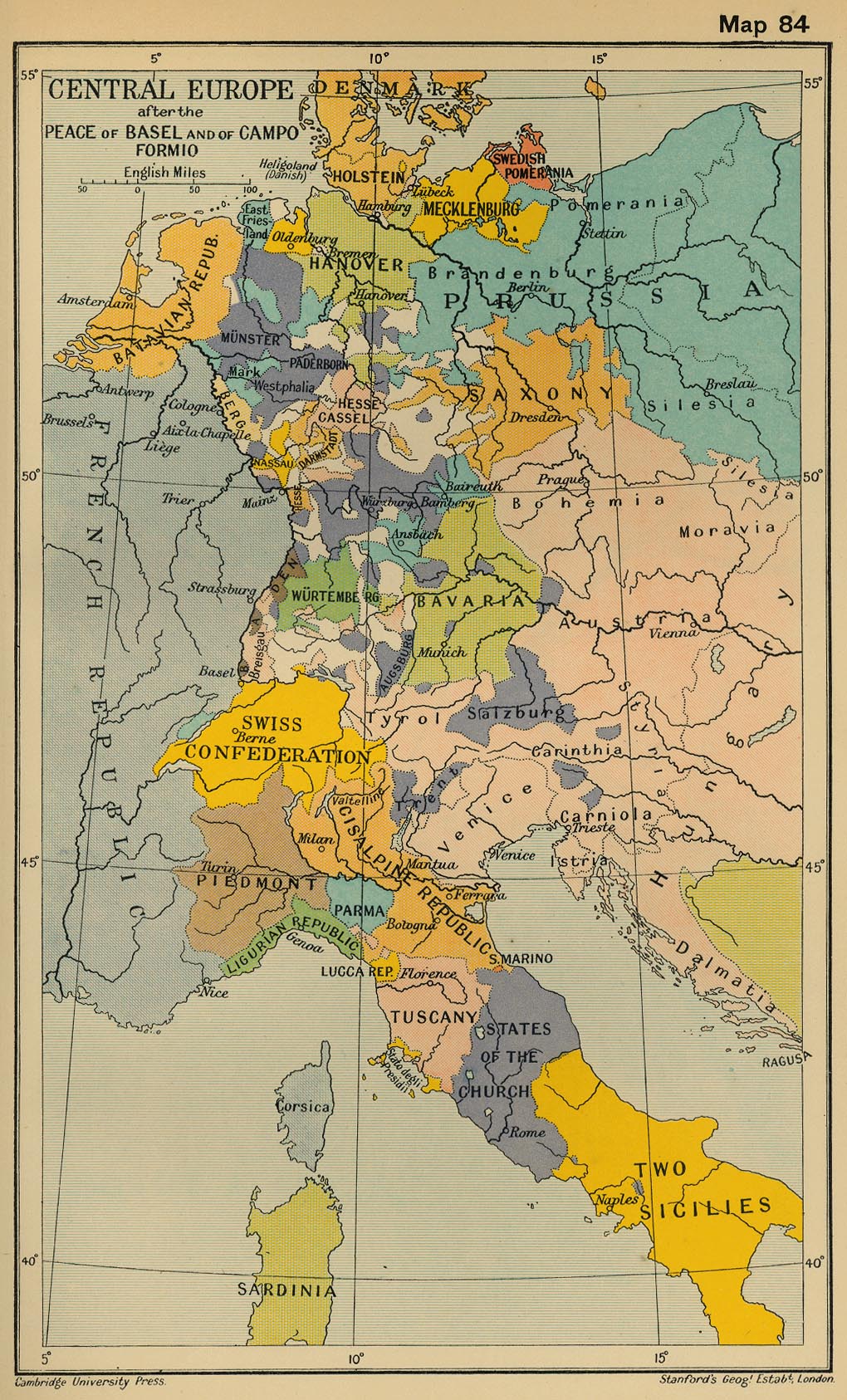
- Central Europe after the Peace of Basel and of Campo Formio (Cambridge Modern History Atlas, 1912)
- Italy in 1799 (Droysens Allgemeiner Historischer Handatlas, 1886)
- Italy in 1799 (Cambridge Modern History Atlas, 1912)
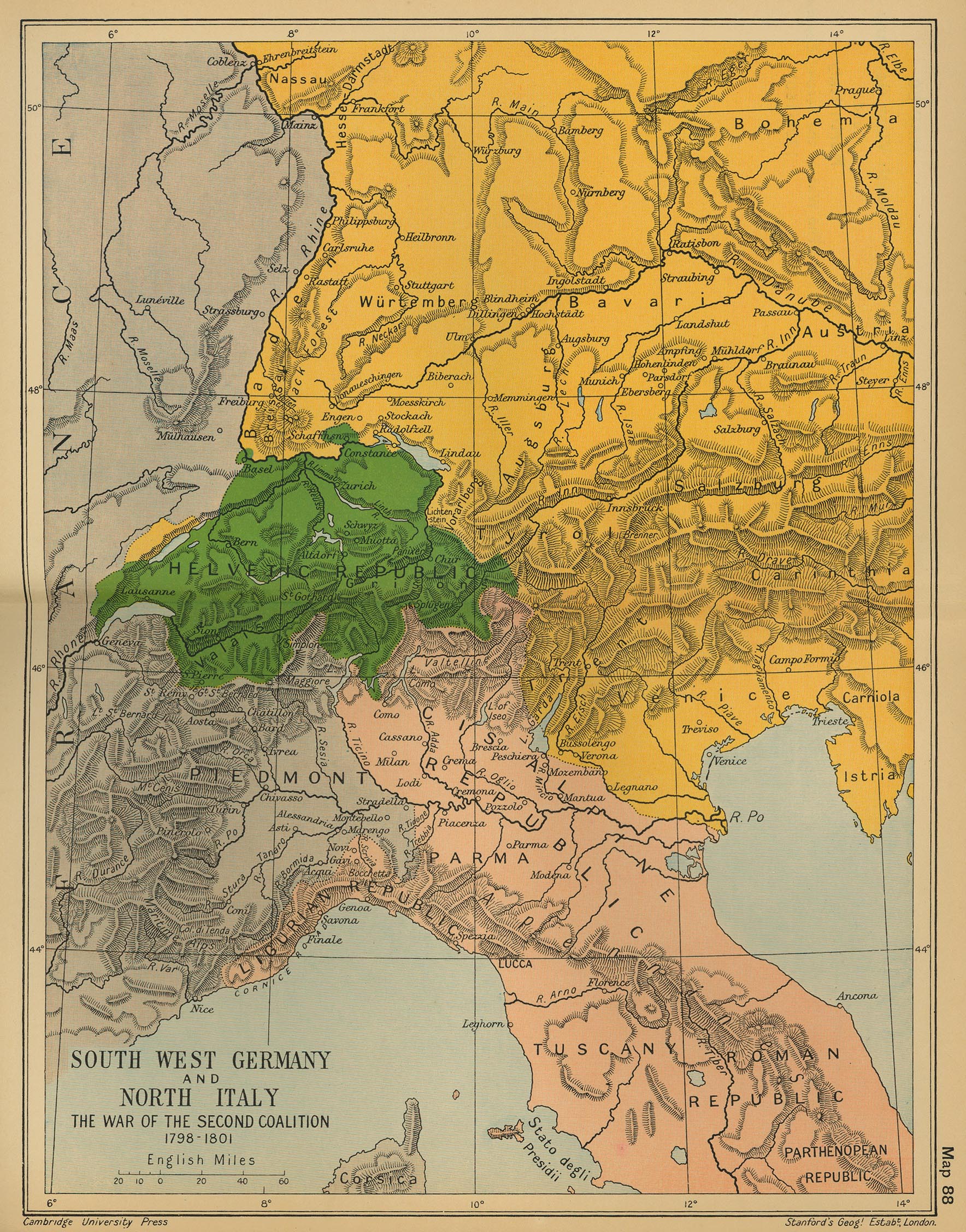
- South West Germany & North Italy: The War of the Second Coalition 1798-1801 (Cambridge Mod. Hist. Atlas, 1912)
- Germany and Italy in 1803 after Principal Decree of the Imperial Deputation