Historical Maps of Scandinavia
MAP COLLECTIONS & atlases
- Blank and Outline Maps of Denmark (d-maps.com)
- Denmark: Historical Maps Collection (Library of Congress)
- Historical Maps of Denmark (American Geographical Society Library Digital Map Collection)
- Historical Maps of Denmark (David Rumsey Map Collection)
- Old Maps of Denmark (oldmapsonline.org)
- Blank and Outline Maps of Finland (d-maps.com)
- Finland: Historical Maps Collection (Library of Congress)
- Historical Maps of Finland (American Geographical Society Library Digital Map Collection)
- Historical Maps of Finland (David Rumsey Map Collection)
- Old Maps of Finland (oldmapsonline.org)
- Blank and Outline Maps of Norway (d-maps.com)
- Historical Maps of Norway (American Geographical Society Library Digital Map Collection)
- Historical Maps of Norway (David Rumsey Map Collection)
- Norway: Historical Maps Collection (Library of Congress)
- Old Maps of Norway (oldmapsonline.org)
- Blank and Outline Maps of Sweden (d-maps.com)
- Historical Maps of Sweden (American Geographical Society Library Digital Map Collection)
- Historical Maps of Sweden (David Rumsey Map Collection)
- Old Maps of Sweden (oldmapsonline.org)
- Sweden: Historical Maps Collection (Library of Congress)
MAPS
- The Baltic Lands, c. 1000 (E. Freeman, The Historical Geography of Europe, 1903)
- Denmark in the 11th and 13th Centuries (Putzgers Historischer Weltatlas, 1905)
- The Baltic Lands, c. 1220 (E. Freeman, The Historical Geography of Europe, 1903)
- Norway, c. 1250
- The Baltic Lands, c. 1270 (E. Freeman, The Historical Geography of Europe, 1903)
- The Baltic Lands, c. 1350-1360 (E. Freeman, The Historical Geography of Europe, 1903)
- Decline of German Power in the Baltic Region, 1380-1560 (William Shepherd, Historical Atlas, 1926)
- Scandinavia before the Union of Kalmar. Maps of Scandinavian History (Droysens..., 1886)
- L’Union de Kalmar de 1397 (Jacques Leclerc)
- German North Sea and Baltic States in the 14th and 15th Centuries (Putzgers Historischer Weltatlas, 1905)
- The Decline of the German Baltic States (Putzgers Historischer Weltatlas, 1905)
- The Baltic Lands, c. 1400 (E. Freeman, The Historical Geography of Europe, 1903)
- The Baltic Lands, c. 1478 (E. Freeman, The Historical Geography of Europe, 1903)
- Scandinavia, 1521-1648 (R. Lane Poole, Historical Atlas of Modern Europe, c.1900)
- Scandinavia in the time of Gustavus Vasa (Cambridge Modern History Atlas, 1912)
- Expansion of the Swedish Empire, 1560-1660
- Expansion of the Swedish Empire, 1560-1660
- Eastern Baltic and Northern Poland: Wars of Sweden with Poland and Russia 1560-1661 (Cambridge..., 1912)
- Sweden, 1560-1721
- Sweden, 1561-1658
- The Baltic Lands, c. 1563 (E. Freeman, The Historical Geography of Europe, 1903)
- The Baltic Lands, c. 1617 (E. Freeman, The Historical Geography of Europe, 1903)
- Denmark, 1648 (ieg-maps)
- Sweden, 1658 (Putzgers Historischer Weltatlas, 1923)
- Sweden about 1658 (William Shepherd, Historical Atlas, 1923)
- Sweden, 1660-1905
- The Baltic Lands 1661 (Cambridge Modern History Atlas, 1912)
- Sweden, c. 1700 (Hans Hogman)
- Scandinavia, Russia and Poland: The Northern War, 1700-21 (Cambridge Modern History Atlas, 1912)
- The Baltic Lands, c. 1701 (E. Freeman, The Historical Geography of Europe, 1903)
- The Baltic Lands, c. 1772 (E. Freeman, The Historical Geography of Europe, 1903)
- The Baltic Lands, c. 1795 (E. Freeman, The Historical Geography of Europe, 1903)
- Sweden in the Second Half of the 18th Century
- The Baltic Lands, c. 1809 (E. Freeman, The Historical Geography of Europe, 1903)
- Finland, 1840: Population Density
- Finland: the Grand Duchy of Finland, 1857
- Denmark and the Duchies of Schleswig and Holstein: The War of 1864 (Cambridge Modern History Atlas, 1912)
- Finland, 1875: Population Density
- Finland, 1918
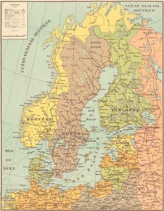
- Scandinavia and Denmark, 1920
- Finland, 1920-1940: Administrative Map
- Finland, 1942
- Finland, 1942-1944: Administrative divisions


