Historical Maps of Ukraine: Before the Russian Invasion
MAP COLLECTIONS & atlases
- Blank and Outline Maps of Ukraine (d-maps.com)
- Cartes historiques de l’Ukraine (Gallica - Bibliothèque nationale de France)
- Historical Maps of Ukraine (American Geographical Society Library Digital Map Collection)
- Historical Maps of Ukraine for Classroom Use (Shkolnaja laboratorija po istorij)
- Old Maps of Ukraine (oldmapsonline.org)
- Ukraine: Historical Maps Collection (Library of Congress)
MAPS
- Kievan Rus (IXth-XIIth Centuries)
- Kievan Rus in the 11th century (P. Magocsi, Historical Atlas of Ukraine, 1987)
- Kievan Rus’ during the XIIth & the XIIIth Centuries
- Kievan Rus’ at the Time of Mongol Invasion, c. 1240
- Russian Lands at the End of the XIVth Century
- Grand Duchy of Lithuania between the XIIIth & the XVth Centuries
- L’Empire Lituanien sous la domination de Vytautas le Grand (1392-1430)
- Ukrainian Lands in the 15th Century
- Liberation War of the Ukrainian People, 1648-1654
- The Cossack Hetman state after 1649
- The Cossack state, 1648-1649
- The Hetman state under Bogdan Khmelnytsky, ca. 1650
- The Hetman state, ca. 1750
- Southern Ukraine in the Second Half of the 18th Century
- Southern Ukraine in the 19th and 20th Centuries
- Linguistic Map of Ukraine (Southern Russia), 1871
- Ethnographic Map of Ukraine, cca. 1900
- Ukrainian Lands, 1914-1919
- The Ukrainian Lands in 1917-1921
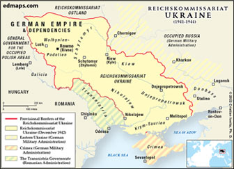
- Ukraine, March-November 1918: German Occupation & Hetmanate
- West Ukrainian People’s Republic, 1919
- Greater Ukraine, 1919 (A Nationalist View)
- Ukraine, May-November 1919
- Economic Map of the Ukrainian SSR in 1921-1928
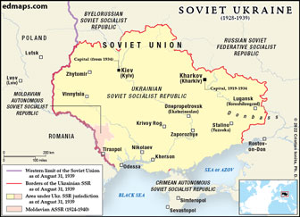
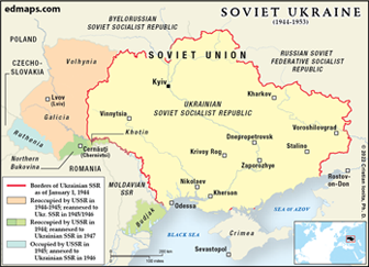
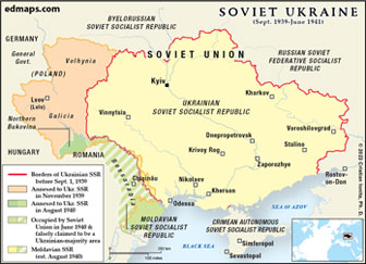
- Ukrainian SSR in 1939
- Ukrainian SSR - Economic Map
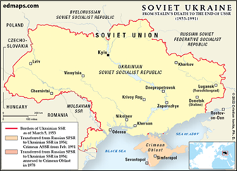
- Ukraine during the De-Stalinization (1953-1964)
- Ukrainian SSR in 1970
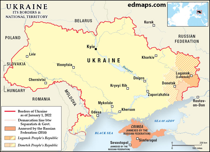
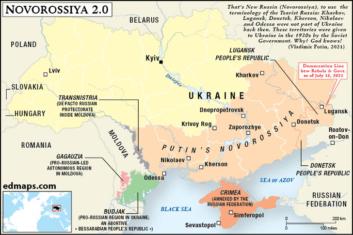
- Ukraine 1991-2014
- Ukraine 2004: Election Results (Washington Post)
- Ukraine 2010: Presidential Election Results
- Ethno-linguistic Map of Ukraine
- Linguistic Map of Ukraine (2003)
- Map of the Ukrainian Dialects
- The Ukrainian Crisis and the Cyberspace (Kevin Limonier)
- Republic of Crimea 2014 (Annexed by Russia)


