More Historical Maps of Canada (1)
MAP COLLECTIONS & atlases
- Atlas of Canada (Natural Resources Canada)
- Atlas historique du Canada français (Maurice Trudel, 1961)
- Blank and Outline Maps of North America (d-maps.com)
- Blank and Outline Maps of Canada (d-maps.com)
- Canadian Historical Maps and Prints (Dalhousie University)
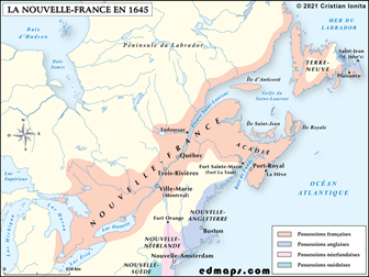
- Cartes géographiques historiques de la Nouvelle-France
- Historical Atlas of Canada (Online Learning Project)
- Historical Boundaries of Canada (The Canadian Encyclopedia)
- Historical Maps of Canada (University of Alabama)
- Historical Maps of Canada: 1667-1999 (Library and Archives Canada)
- Maps, Charts and Architectural Plans Collection (Library and Archive Canada)
- Maps of the Acadian Deportation, Migration, and Resettlement (Canadian-American Center - Univ. of Maine)
- Old Maps of Canada
- The Canadian County Atlas Digital Project (McGill University)
- The W. H. Pugsley Collection of Early Canadian Maps (McGill University)
- Aboriginal Maps (Aboriginal Mapping Network)
- First Nations Maps (Gabriel Dumont Institute)
- Hudson’s Bay Company Fur Trade Post Maps (Hudson’s Bay Company Archives - Govt. of Manitoba)
- Stations Network Map / Carte des gares & propriétés (ViaRail)
- Political Maps of the Métis Nation (Gabriel Dumont Institute)
- Old Alberta and Saskatchewan Maps: Online Historical Map Digitization Project
- Alberta: Digital Map Collection (Provincial Archives of Alberta)
- Historical Maps of the Prairie Provinces (University of Alabama)
- Historical Maps of Calgary and Alberta (University of Calgary)
- Atlas of Alberta Railways (University of Alberta)
- Historical Maps of British Columbia (University of Alabama)
- Historical Maps Collections: British Columbia & Canada (University of British Columbia)
- Historical Cartographic Collections: British Columbia & Canada (University of Victoria)
- Newfoundland Historical Maps (Memorial University of Newfoundland)
- Newfoundland and Labrador Historical Maps (Memorial University of Newfoundland)
- Historical Maps of Nova Scotia (Nova Scotia Archives)
- Historic Maps of Prince Edward Island (University of Prince Edward Island)
- Atlas of the Maritime Provinces of the Dominion of Canada (Roe Brothers, 1878, University of P.E.I.)
- Illustrated Historical Atlas of the Province of Prince Edward Island (Meacham, 1880, University of P.E.I.)
- Atlas of Province of Prince Edward Island (Cummins, 1918, University of P.E.I.)
- Historical Maps of the Maritime Provinces & Newfoundland (University of Alabama)
- Historical Maps of Ontario (Upper Canada)
- The Changing Shape of Ontario (Ontario Archives)
- Ontario Historical County Maps Project (University of Toronto)
- Atlas du Québec (Gouvernement du Québec)
- Atlas of Saskatchewan (K. I. Fung & others)
- Historical Maps of Yukon/Northwest Territories (University of Alabama)
- Yukon: First Nations Traditional Territory Map Data (Government of Yukon)
- Calgary: City of Calgary Map Gallery
- Edmonton: Historical Map Collection (City of Edmonton Archives)
- Edmonton: Historical Maps - Centennial 1912-2012 (University of Alberta)
- Kingston: Historical Maps - City of Kingston
- London: London Historic Maps Collection (University of Western Ontario)
- Montreal: Atlas of the City & Island of Montreal, 1879 (H. W. Hopkins, ed.)
- Montreal: Maps and Plans of the City of Montreal (Archives de Montréal)
- Montreal: Historical Maps of the Port of Montreal
- Niagara Historical Maps of Niagara (Brock University)
- Ottawa: Old Maps of Ottawa (Ottawa’s History and Heritage in Pictures)
- Regina: The Early Years (City of Regina Archives Map Collection)
- Thunder Bay: Historic Maps (City of Thunder Bay)
- Toronto: Historical Maps of Toronto
- Toronto: Maps of the City of Toronto from 1792
- Toronto: Atlas of the City of Toronto and Suburbs (Charles Goad, 1884-1924)
- Vancouver: Maps of the City of Vancouver & Its Hinterland (City of Vancouver Archives)
- Victoria: Victoria’s Early History: Maps (University of Victoria)
- Winnipeg: Winnipeg Historical Maps
- War of 1812 in Maps (War of 1812 Bicentennial)
- Canada and the First World War (Canadian War Museum)
- The Western Front, 1914-1918 - Canadian Operations (Veterans Affairs Canada)
- The Western Front, 1914-1918 - Canadian Operations (McMaster University)