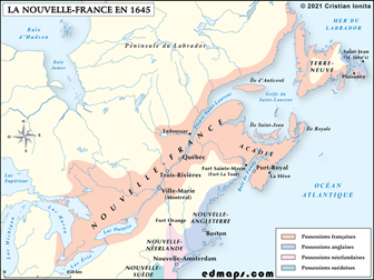
More Historical Maps of Canada (2)
MAPs
- Discovery of North America (The National Atlas of the United States of America, 1970)
- Linguistic and Tribal Distribution of First Nations Groups in Canada, Contact Period (Gabriel Dumont Institute)
- Canada : European Explorations, 1534-1811 (Grolier)
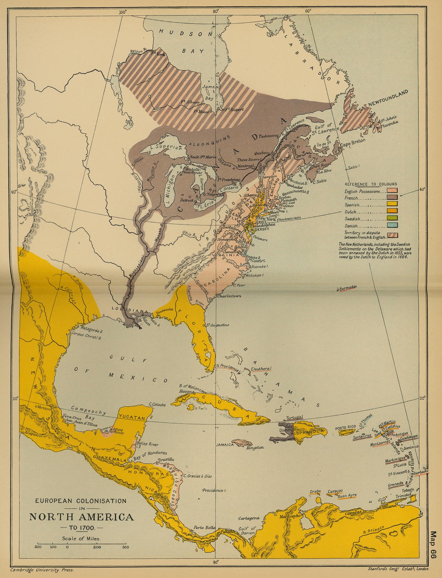
- European Colonisation in North America, c. 1700 (Cambridge Modern History Atlas, 1912)
- North America (Droysens Allgemeiner Historischer Handatlas, 1886)
- British and French Settlements in North America, 1755 (John Hinton)
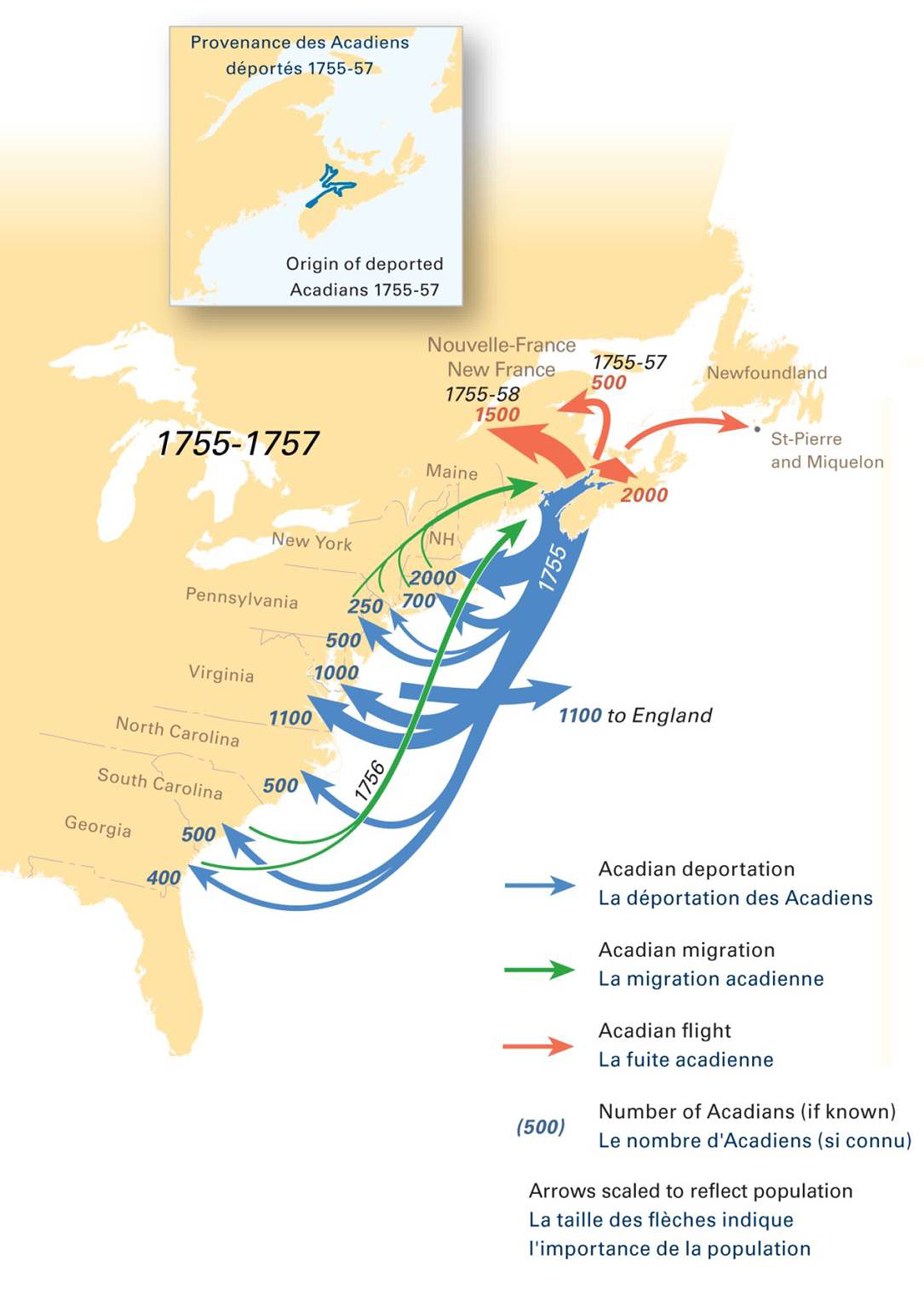
- Acadian Deportation, 1755-1757
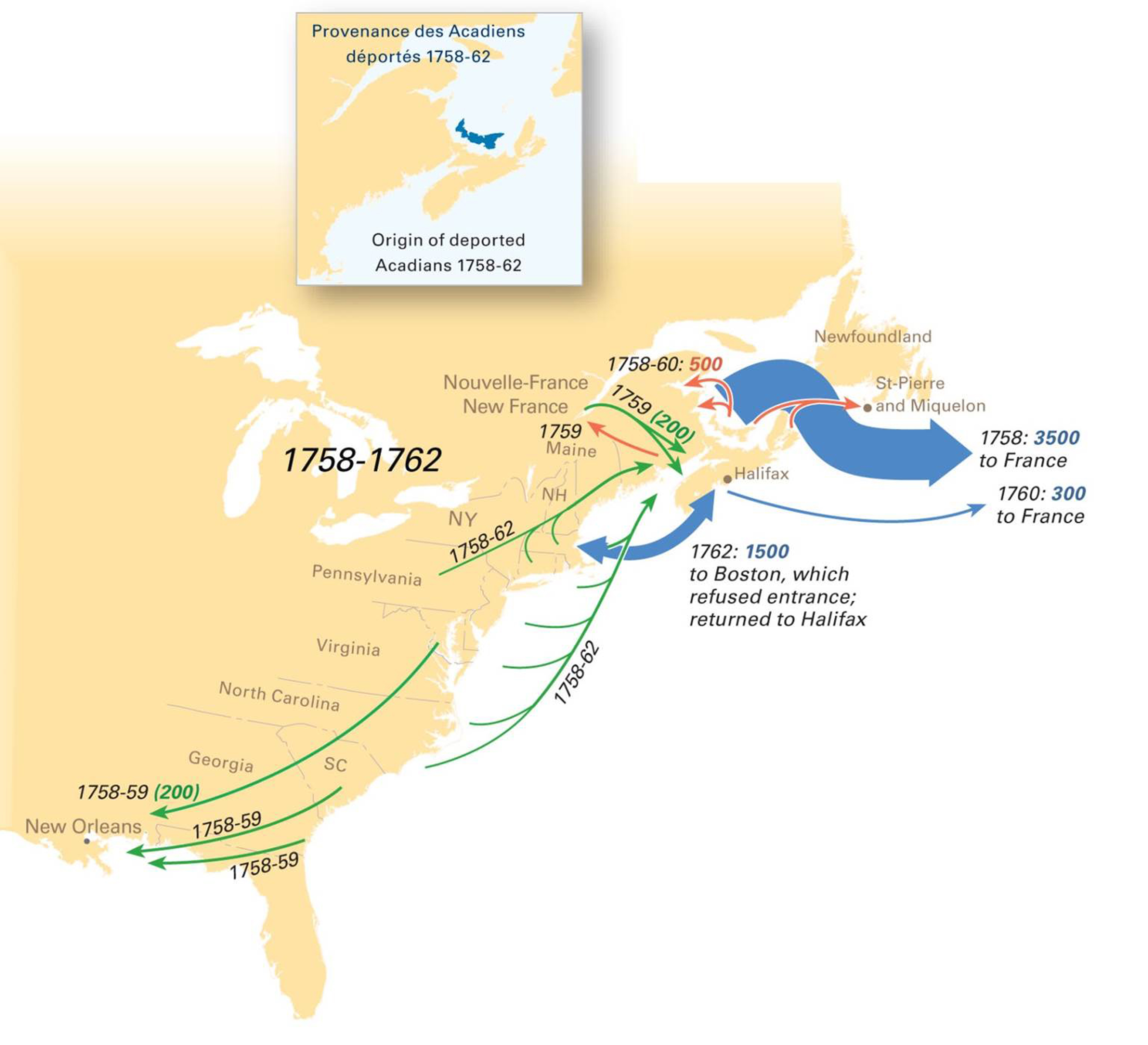
- Acadian Deportation, 1758-1762
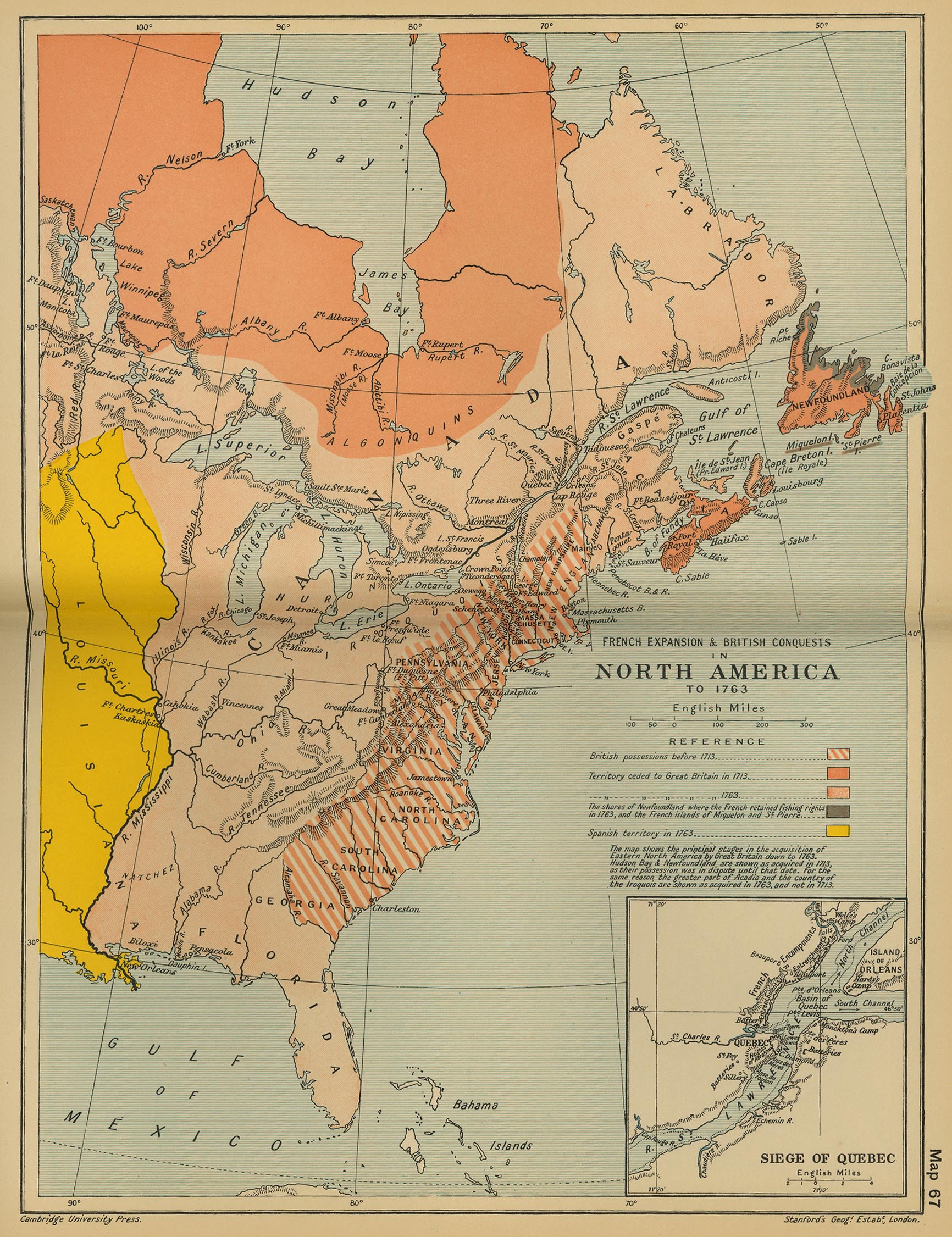
- French Expansion and British Conquests in North America, c. 1763 (Cambridge Modern History Atlas, 1912)
- North America, c. 1763 (Putzgers Historischer Weltatlas, 1923)
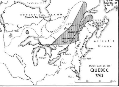
- Boundaries of Quebec, 1763
- Province of Quebec, 1774 (Encyclopaedia Britannica, 2005)
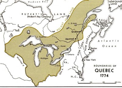
- Boundaries of Quebec, 1774
- British North America (with the Hudson’s Bay Company Territorial Claims), 1850
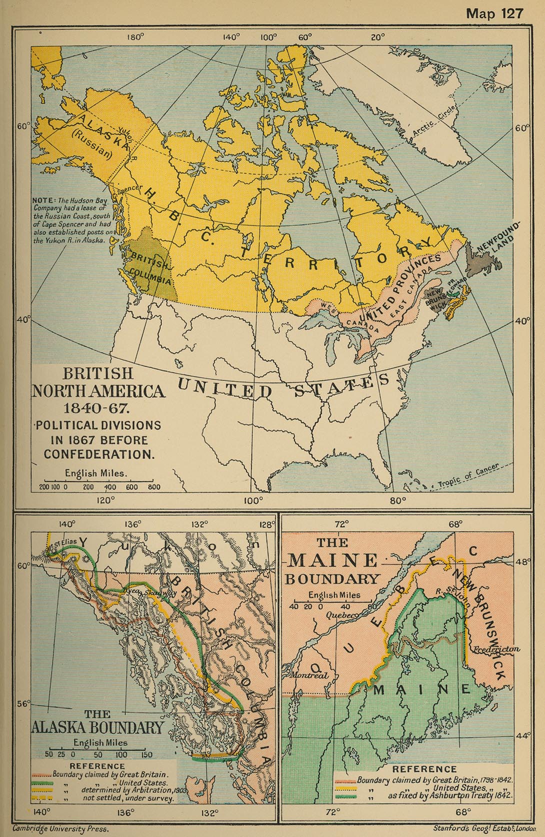
- British North America 1840-1867; Political division, 1867, before Confederation (Cambridge Modern Hist. Atlas, 1912)
- Dinsmore’s Complete Map of the Railroads & Canals in the United States & Canada, 1856
- Canada, 1870
- North-West Territories, 1870-1905 (The Canadian Encyclopedia)
- Canada, 1873
- Dawson’s Map of the Dominion of Canada, 1873
- Canada - Map Showing Location of Some of Principal Products, also Railways & Water Routes, 1878
- Dominion of Canada, 1898 (W. & A. K. Johnston)
- Canada - Map Showing Grand Trunk Pacific Railway, 1903
- Canada - Map of the National Transcontinental Railway, 1904 (Canada Dept. of the Interior)
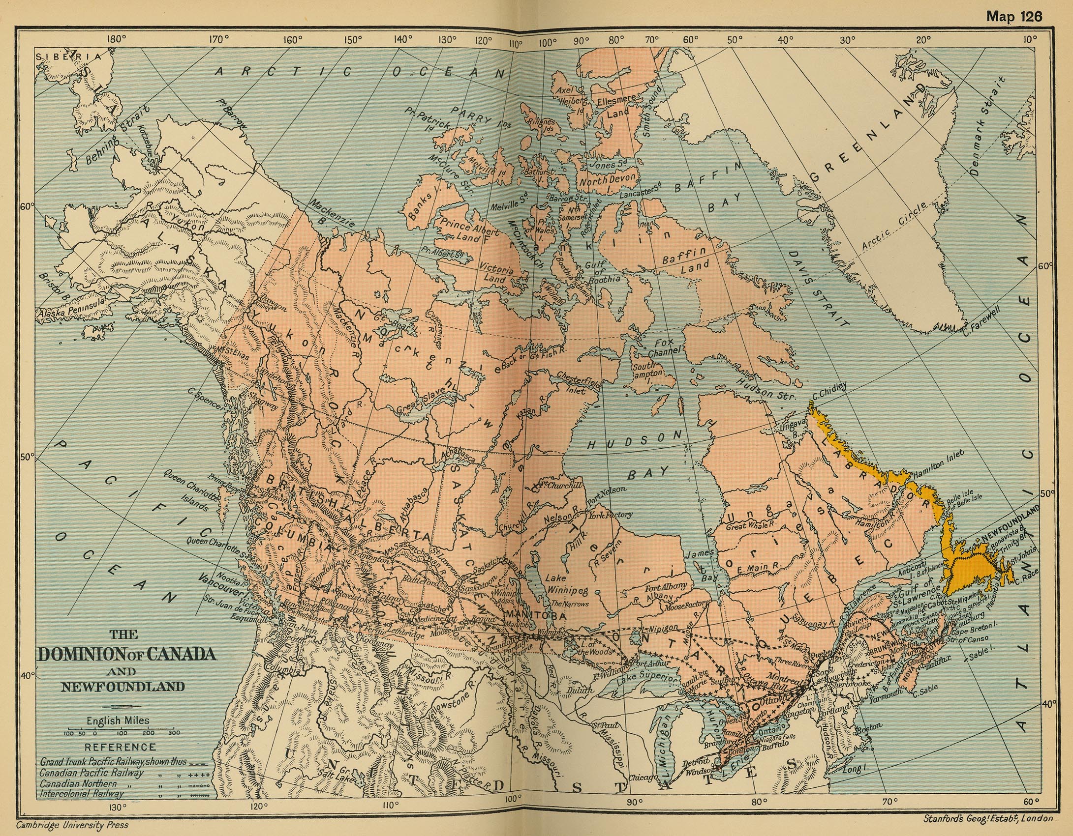
- The Dominion of Canada and Newfoundland (Cambridge Modern History Atlas, 1912)
- Dominion of Canada, 1914 (Canada Dept. of the Interior)
- Canada’s Participation in the First World War (1914-1918) (The Canadian Encyclopaedia)
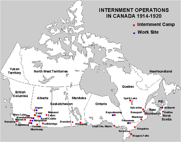
- Internment Operations in Canada, 1914-1920
- Dominion of Canada, 1920 (Times Survey Atlas of the World, 1920)
- Dominion of Canada, 1924 (Canada Dept. of the Interior)
- Dominion of Canada - Vegetation & Forest Map, 1930 (Canada Dept. of the Interior)
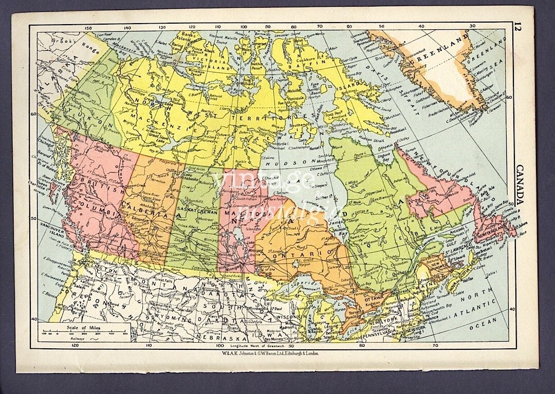
- Canada, 1950
- Canada’s Current Marine Protected Areas (MacLean’s)
- Canadian Peacekeeping Map
- Canadian Armed Forces Current Operations Map (Government of Canada)